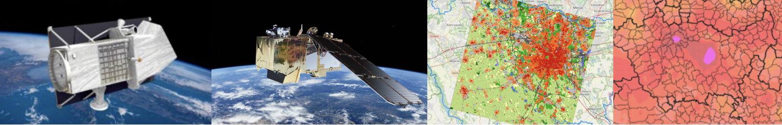
In the picture above, from left to right, you can see the PRISMA and Sentinel-2 satellites, the Local Climate Zones (LCZ) map of the metropolitan city of Milan, and a map of air temperature in the same area.
But what is a Local Climate Zones map? How can we create this map? What role do satellites play in its generation?
We all experience the urban heat island phenomenon—namely, the higher temperatures in cities compared to natural areas. To support the mitigation of this phenomenon, digital thematic maps, known as LCZ maps, can be generated from satellite multispectral and hyperspectral images. Different colors in these maps represent areas with distinct local climates.
This is what geoinformatics engineers specialize in. They understand satellite missions for environmental monitoring, the electromagnetic radiation that enables remote sensing of the Earth, and the satellite image processing techniques required to generate thematic maps.
Subjects covered include Earth Observation, GIS, Image Analysis, Geospatial Data Analysis, and Geospatial Processing.