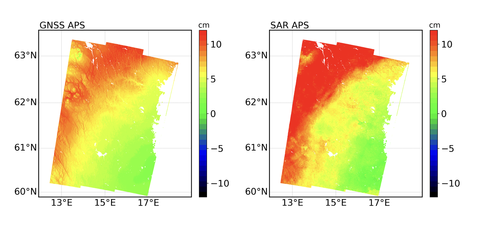
In the figure above, you can see two maps of atmospheric water vapor content over Sweden. These maps, called Atmospheric Phase Screens (APSs), are derived from two different datasets for the same period and area. The map on the left is derived from Global Navigation Satellite System (GNSS) observations, while the map on the right is derived from satellite Synthetic Aperture Radar (SAR) images.
Two observation systems produce different results. Why?
Is GNSS the same system used for navigation? How can it measure atmospheric water vapor content? What is Synthetic Aperture Radar, and what is the relationship between a positioning satellite system and a satellite SAR mission?
Geoinformatics Engineering will introduce you to both the GNSS satellite positioning system and SAR satellite missions. You will learn how to model and process GNSS and SAR data to produce maps of water vapor content from the delay this atmospheric component induces in the propagation of GNSS and SAR electromagnetic signals.
Subjects covered include Positioning and Location-Based Services, Earth Observation, Geospatial Data Analysis, and Geospatial Processing.